West Hants Christmas Bird Count
Updated: April 2024
Compiler: Patrick Kelly
Count Date: Most recent count Jan. 3, 2024
All of the results for the West Hants Bird Counts are available and searchable on the Audubon Societies website here. The write up of the 2022 and 2023 bird counts from Beyond the Tides is downloadable here.
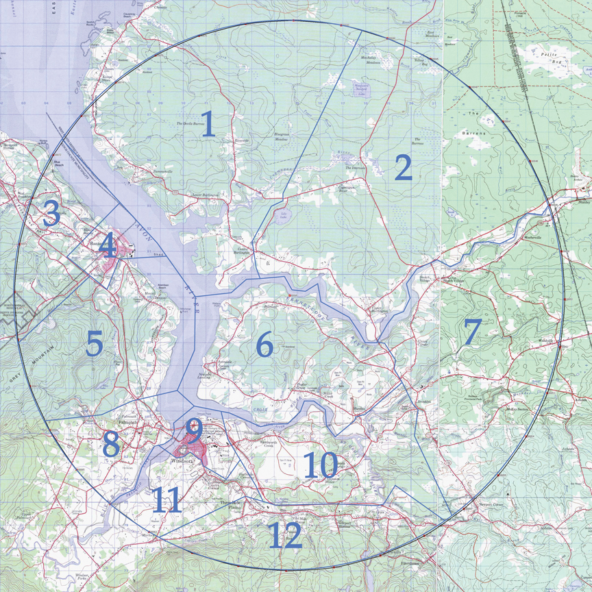
Adjacent is a general map showing the count circle, divided into 12 areas to be surveyed by twelve teams/field parties.
Detailed maps of the 12 areas are available. Select the area of interest with the links below that show the topographic map of the area and the Google map satellite image to get a sense of the terrain:
1 – Summerville (topo map; satellite map)
2 – Walton Woods Road (topo map; satellite map)
3 – Lockhartville (topo map; satellite map)
4 – Hantsport (topo map; satellite map)
5 – Mount Denson (topo map; satellite map)
6 – Avondale Loop (topo map; satellite map)
7 – Smileys (topo map; satellite map)
8 – Falmouth (topo map; satellite map)
9 – Windsor (topo map; satellite map)
10 – Sweets Corner (topo map; satellite map)
11 – Chester Road (topo map; satellite map)
12 – Three Mile Plains (topo map; satellite map)